Bardenas Reales of Navarre
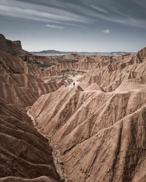
A 3 km a poca distancia de las Casas de las Cuevas de Bardenas (Bardeneras) se encuentra el acceso al Parque Natural de los Reales de Navarra, declarado Reserva de la Biosfera por la UNESCO. El paisaje desértico más grande de Europa, muchos rincones pintorescos y formas caprichosas a través del paisaje que crean efectos casi lunares. Los visitantes pueden seguir diferentes rutas a pie, en bicicleta, en coche o en jeep 4X4 y descubrirán impresionantes vistas como Castildetierra, El Rayón o Piskerra.
Origin of the Bardenas
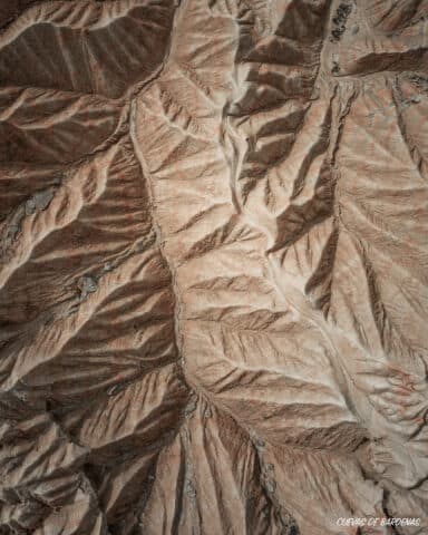
To find the origin of this desert, it is necessary to go back 56 million years, when the formation of the Pyrenean chains and the Iberian Cordillera caused the sinking of the central area of the Ebro, creating an inland sea. 10 million years ago, with the emptying of this sea towards the Mediterranean, the formation of the characteristic landscape of Bardenas begins, due to the erosion of the sediments that for millions of years had been deposited at the bottom of this inland sea. It is estimated that these sediments currently have a depth of 4 km.
Areas of the Royal Bardenas of Navarre
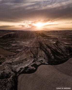
The Bardenas Reales de Navarra have 45 kilometres from north to south and 24 kilometres from east to west, and their altitude varies between 280 and 659 metres. The Natural Park is divided into several to very different areas, both for its historical uniqueness and for its natural attractiveness.
Bardena Half note
It is the most desert area, the most spectacular and the most visited. It is where all the geological formations that have been eroded by wind and water are located, creating surprising and spectacular forms: ravines with seasonal rivers, plateaus, hills, and incredible heads like Castildetierra.
Within the Bardena Blanca is located the place called “Rincón del Bú”, declared a natural reserve. It highlights its unique orography in which erosion has had a lot of influence. In this area we can find a wide variety of birds of prey such as moose, golden eagle, caravan, lark, and a long etcetera.
Bardena Black
It is located on the border with Aragon. It owes its name to the vegetation that grows in this area, thanks to which it acquires a blackish green colour.
In the Bardena Negra there is an area of land called “Caídas de la Negra”. Here there are owls, vultures, eagles, foxes, mountain cats, amphibians, reptiles, etc. abound here. In this area, also declared a nature reserve, vegetation and bushes abound.

The Plane
It is a small plateau about 100 metres high above the surrounding land, where cereal is grown. The slopes of this plateau are covered with coscojares, romerales and ontinares.

Vedado de Eguaras
It is located in the heart of the Bardenas Reales in the municipality of Valtierra. It is an area of land similar to an oasis within the desert area. In this corner, declared a natural reserve, are the ruins of the castle of Peñaflor: in this fortress – according to legend – she was enclosed Blanca I of Navarra by her father when she refused to marry the prince of Aragon